Having fun amidst the rain while trekking has its own level of excitement. When the Southwest monsoon winds bring the clouds hovering above Maharashtra, it’s time for the trekkers and nature enthusiasts to climb up the mountains and forts that can offer them some adventure and exhilarating fun. The Western Ghats offer so much more to the trekkers and nature lovers who want to explore the rugged topography and rocky mountains and walk through the extensive forest network that otherwise remains unexplored. In my previous post, I covered trekking destinations in Maharashtra for basic and medium level trekkers. In this one, we continue our trek journey, but focus on places that can raise the bar to the next level.
Harishchandragad Fort
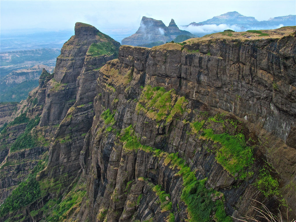
Harishchandragad Trek
Nestled in the Ahmednagar, Harishchandragad Fort is known for its great history and for being one of the strategic forts during the Maratha regime. The fort is located in a way to keep an eye on the surrounding areas and therefore it offers a great view from the top. However, to reach to the top, trekkers need to go through some tough terrain and rocky cliffs. Expert trekkers can also do some rappelling, rock climbing and valley crossing while trekking Harishchandragad.
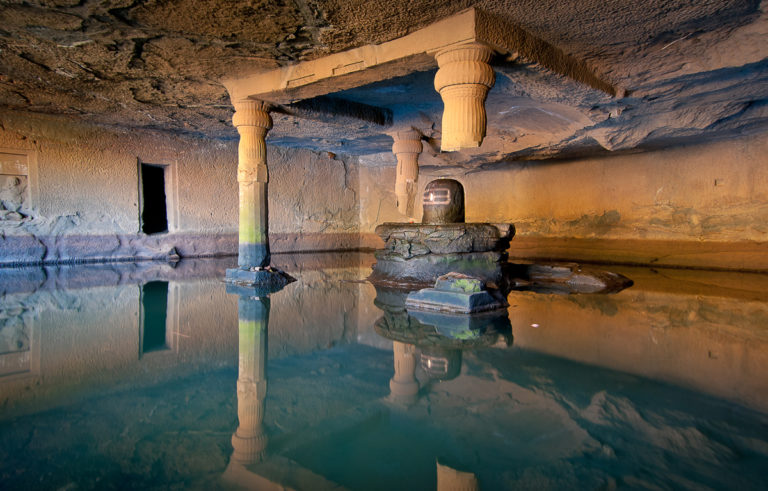
Kedareshwar Temple at Harishchandragad Fort
The fort is around 4,671 feet above the sea level and it takes approximately 7 hours to reach the top. You can also camp here, if you want, but make sure you carry plenty of food and water along. The fort also has 9 caves on the top where you can take a halt. During the monsoon season, ensure that you carry first aid kit along and pay close attention to slippery rocks. You also get to visit the Kedareshwar Temple that stands on four pillars, but three of the pillars are broken. Locals believe that the world comes to an end when the fourth and the only pillar breaks. Interesting, isn’t it?
Vasota Fort
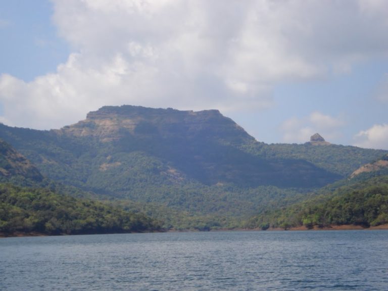
Vasota Fort
Are you ready to take on any challenge that nature throws at you? Well, if you’re prepared for a tough challenge, Vasota Fort located near Koyna Wildlife Sanctuary should be at the top of your list. The fort, located 3,842 feet above the sea level, is covered by some thick forest and wildlife and therefore it only adds to the excitement. The contours of the hills are eye-appealing and you would also want to do some wildlife photography here. This place offers the most thrilling wildlife trek experience in the state with leopards and wild bears out in the open.
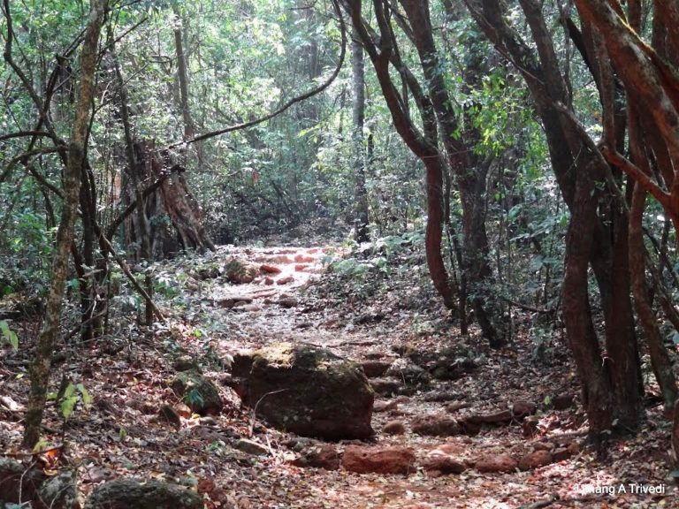
Vasota Fort Way Up
The fort is also closely located to the Shiv Sagar Lake and when you reach the top you see a panoramic view of the lake. While trekking near Vasota Fort make sure you stay in the group and you have an expert that knows the way or you may get lost in the dense vegetation. Carry enough potable water and food while you are here along with first aid kit. Leeches can create more problems for you so make sure you know how to protect yourself from it.
Kalsubai Peak
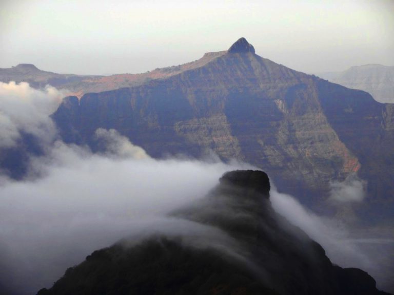
Kalsubai Peak Maharashtra
Do you often feel the urge to put a flag on the top of the Mount Everest, but you know that’s a long shot? Well, here’s an alternative. The Kalsubai Peak is the highest peak in the state of Maharashtra, also called as the ‘Everest of the Sahyadris’. At 5,500 feet above the sea level, Kalsubai Peak is a dream for every avid trekker. Located in the Igatpuri taluka, this one can really put your courage and stamina to the test with rugged topography and hilly terrain.
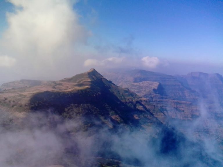
Kalsubai Peak
There are some parts where the climb is really steep and that’s where you need to be cautious especially during the monsoon. The trek starts from the Bari village and it should take around 3-4 hours to get to the top. The peak can offer place for just three people at the top edge, but you get a panoramic view of the villages around. During the monsoon, the misty climate can block your view, but it still offers a blood-pumping experience.
Ratangad Fort
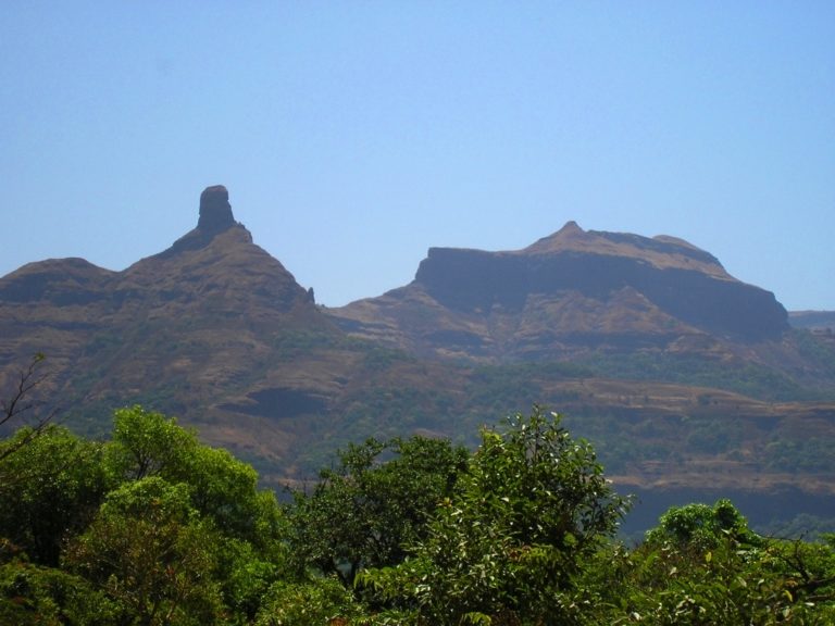
Ratangad Trek
Not too far from the Kalsubai Peak is Ratangad Fort which offers an equal share of adventure and thrills. The fort overlooks the village of Bhandardara and it has a history that dates back 2000 years. Those who are interested in history, please take note of this. To start the trek you need to be at Bhandardara and from here you take a 6 kilometers (3.7 miles) boat ride and get down at the other end. You walk another 4 kilometers (2.4 miles) and then come to the base village – Ratanwadi. This is where your trek actually begins. The climb is not quite easy and therefore basic trekkers should avoid it. If you love photography, Ratangad Fort trek can offer you great pictures because the fort is covered by flora and fauna at the foot.
Rajgad Fort
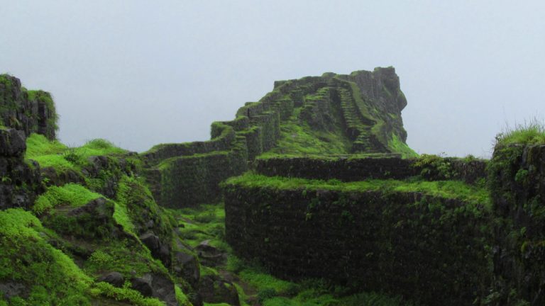
Rajgad Fort
If you’re close to Pune, Rajgad Fort trek is a great option to offer yourself some adventure and fun. It is one of the grandest forts in the region and during the monsoon the lush green carpet makes it even more picturesque. Photographers can certainly try their hands at this one as the fort offers a spectacular view from the top. The fort is located 4,250 meters above the sea level and it attracts visitors throughout the year.
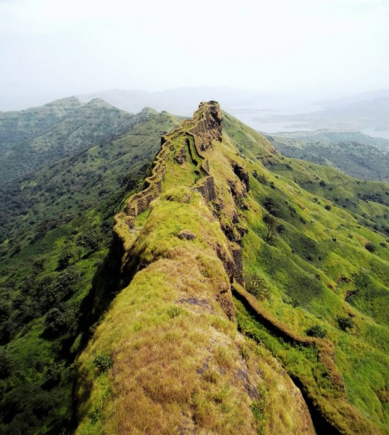
Rajgad Fort Suvela Machi Area
To get started you need to head to the Gunjawane village and start trekking up from there. Some parts of the trek are challenging and can consume your energy levels, so you can take a halt for few minutes before you restart. You can also take some energy drinks along or water to keep yourself hydrated at all times. During the monsoon, environment is bit chilly due to clouds and mist, so keep that in mind. At the top, there are couple of temples where you can camp to add more to your trekking experience.
Hope you all enjoyed the trekking destinations that I’ve covered. Do let me know your views and some other trek destinations that I’ve missed and I will cover those in the future posts. Thank you.
13 comments
This really is a marvellous planet we live on…
Thanks Paul Ruddock
I wish I was “Jeanie” and could just blink my way there! Have you ever made these hikes? Also, I would love it if sometime you did a post on your local wildlife, hazards and beauty. Great photos and descriptives here, as always my friend!
Yes, I did during my college days with friends, also few hikes with my sister’s relatives. Its fun to be there, smell the grass, the wet soil, see all those tiny insects and butterflies fluttering around while you move up. I always loved going up, but I was scared coming down because gravity can play tricks on you, plus the loose mud and slippery rocks can lead to accidents, so you have to be double-cautious. Can you please elaborate more on that local wildlife hazards and beauty thing?
That sounds marvelous to me I am certain you know. I love being in the woods. The leeches I would NOT like! Eeek.
What I mean is that I have seen a few shots of birds from your town, but about the insects, animals and natural wildlife that is in your area? Those things you might encounter on venturing out. You know I have my own little Jurassic world here. Does the monsoon season flush out any particular kind of creatures that become more prevalent?
The Western Ghats as we call them here are almost like Rocky Mountains in North America. The ecosystem is huge and during the monsoon, a completely different group of birds and insects come out. I will certainly cover the insects in one of my forthcoming posts since Cheryl and you are interested in them.
I look forward to that!
I love this series Sharukh. I love the idea of hiking to a fort. The pictures are awe inspiring and the descriptions would surly encourage me to make the attempt.
Dan, I am glad you liked it and the post sort of encourages you to leave behind your apprehensions and attempt something different.
Breathtaking views, thank you for sharing! Definitely going to check out your other posts. Do you have a favorite travel destination?
You’re welcome and I hope you like my other posts as well as and when you read those. That’s an interesting question from you. Choosing a favorite often puts me in the tight spot. There’s so much to see across India and the world. However, to answer your question, I would say my dream destination is Switzerland. Here you have it.
Hi, Shahrukh. Nice blog. I have a request, please can you implement it? There are many blogs on trekking out there, but the issue is that they do not show the trails exactly (or even naively), in detail. Can you please share the trails using Google Maps or any other way to reach the destination. It will be very helpful to us, who are amateurs.
Thank You,
Chetan Waghela.
Hi Chetan. I have taken note of your request and I will try and implement it as quickly as possible. If I’m able to do it, I will notify you personally via email. Take Care 🙂