Nestled in the Sahyadris, the Lonavala Fort trek is ideal for those who want an adventure without a lot of fuss and experience. This beginner-friendly trail winding through the lush greenery and the quiet hum of the monsoon mist offers a great experience to weekenders.
Despite how accessible this trek is, the payoff is pure magic – panoramic valley views, moss-covered stone paths and a strong Maratha fort with rich history.
One of the things about the Lohagad Fort hike is that you do not need a lot of hiking experience. We began this trek with no prior training, no fancy gear, and not much of a plan. However, after our experience, we would agree that planning is essential to making this trek memorable.

If done the right way, trekking Lohagad Fort would become one of the most memorable experiences near Lonavala.
Whether you’re travelling with family, a group of friends, or solo with a camera, Lohagad offers a slice of nature, history, and serenity.
In this post, we’ll walk you through everything — from how to reach the base village to tips that’ll make your climb smoother, especially if this is your first time.
Why Hike Lohagad Fort?
Because it is easier to hike and accessible. Simple.
However, apart from being readily accessible and easy to hike, Lohagad Fort has a lot of history attached to it. Lohagad isn’t just a fort — it’s a story carved into stone, perched 3,400 feet above sea level, watching over the lush expanse of the Sahyadris.
But history aside, what truly draws people here is the way this trek balances beauty with ease.
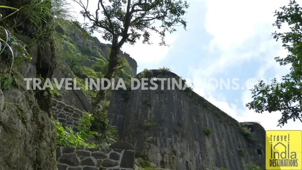
The path isn’t long or steep. You won’t need trekking poles or months of training. What you will get is a trail that hugs the hillside, painted green during monsoon, with views that stretch for miles.
You’ll pass by waterfalls, walk alongside fellow hikers, and feel the thrill of reaching a fort once used by Chhatrapati Shivaji Maharaj himself. If you are someone looking for more historical fort treks, check out our article on Maharashtra forts that are ideal for hikes and history.
How to Reach the Base Village?
Getting to the base village of Lohagad Fort is a breeze, whether you’re cruising in your car or hopping on a train for a scenic journey. Here’s how to make the most of both options and start your adventure hassle-free.
Via Car
One of the easiest ways to reach the Lohagad Fort base village is via car. If you’re in Lonavala, you can drive your way to the Lohagad Fort base in less than 30 minutes. Type the destination in Google Maps as – Lohagad Entry Steps – let the technology do the hard work for you.
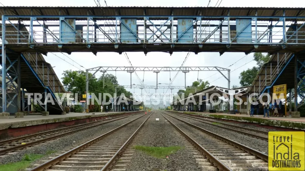
Via Train
Those using public modes of transportation like trains can also easily access this fort trek.
From Mumbai via Train
If you are travelling by train, take any Mumbai–Pune express train and get down at Lonavala. Then, buy a local train ticket at Lonavala station and board the next Lonavala–Pune local heading toward Pune. Get off at the very next stop – Malavli station.
Pro Tip: Train Route I Personally Recommend
For a smooth and well-timed journey, I recommend the 22105 Indrayani Express, which departs CSTM at 5:40 AM and reaches Lonavala by 7:58 AM. This gives you a comfortable 20-minute buffer to buy your local train ticket and catch the 8:20 AM Lonavala–Pune local, reaching Malavli at 8:26 AM.
We took the 12127 Mumbai–Pune Intercity Express, which leaves CSTM at 6:40 AM and reaches Lonavala by 8:48 AM. That gave us more than an hour to relax and enjoy breakfast at Lonavala station before boarding the 10:05 AM Shivaji Nagar local, reaching Malavli by 10:11 AM.
From Pune via Train
Catch the local train from Pune to Lonavala, then follow the same route via Malavli Station.
Take the 9:57 AM local train from Pune to Lonavala, and you’ll reach Malavli by 11:02 AM.
If you prefer earlier timing, you can catch the 11010 Sinhagad Express, which departs from Pune Junction at 6:05 AM and reaches Lonavala by 7:13 AM. This gives you an hour at the Lonavala Station to buy tickets and enjoy breakfast before you catch the 8:20 AM Lonavala-Pune local train and reach Malavli by 8:26 AM.
Hike From Malavli Station to the Base Village
You can either take a rickshaw from the Malavli station that will take you straight to the base village, or you can enjoy the entire 5.6-kilometre hike. The entire railway station to the top of the Lohagad Fort hike should take around three hours.
The Base Village Experience: The Calm Before the Climb
Being at the Lohagad Fort trek base is an experience in itself. This tiny village nestled at the foot of the Lohagad Fort hill is a lively hub with food stalls serving poha, vada pav, corn on the cob (bhutta), chai and soft drinks. A perfect place where you would want to refuel your energy before you climb the fort.
Hikers hiking from Bhaja Caves to Lohagad Fort can unwind here before they ascend the fort. The availability of toilets is also a welcome surprise, especially for female hikers.
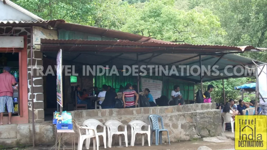
The energy is mixed — some people are just starting, and others are catching their breath after the descent. But the atmosphere remains friendly, communal, and relaxed.
This pause before the hike is more than just logistical. It’s your chance to slow down, soak in the vibe, and get mentally ready for the misty views and slippery stones ahead.
Scaling Lohagad Fort: A Monsoon Adventure to Remember
Ascending Lohagad Fort is not a tough task, but it is certainly not an easy stroll. During the monsoon season, the foliage is thicker, combined with wet ground, uneven stone steps slick with moss can turn into a challenge.
A combination of fun and being aware of the terrain can ensure you a great experience. The ascent rewards you with amazing panoramic views of the surrounding region. If you are into photography, you may want to pause occasionally and capture some breathtaking shots as you go along.
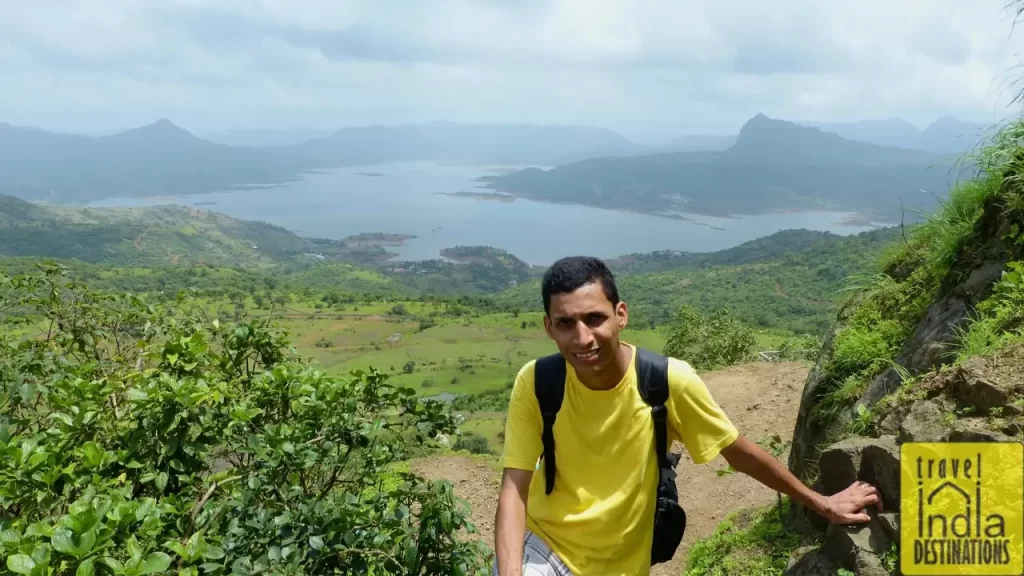
At one point, Sarah and I enjoyed the panoramic views of the Pawna Lake, which stimulated us to keep going further and higher. Generally, the views are misty and surreal, but it wasn’t raining the day we hiked. This allowed us the opportunity to enjoy better views of the region and the surrounding mountains.
Reaching the Legendary Gates of the Lohagad Fort
As you hike toward the top of Lohagad Fort, you’ll pass through four main gates — Ganesh Darwaza, Narayan Darwaza, Hanuman Darwaza, and Maha Darwaza. These aren’t just relics; they’re checkpoints of your progress and a chance to pause, catch your breath, and take in the craftsmanship of the Maratha era.
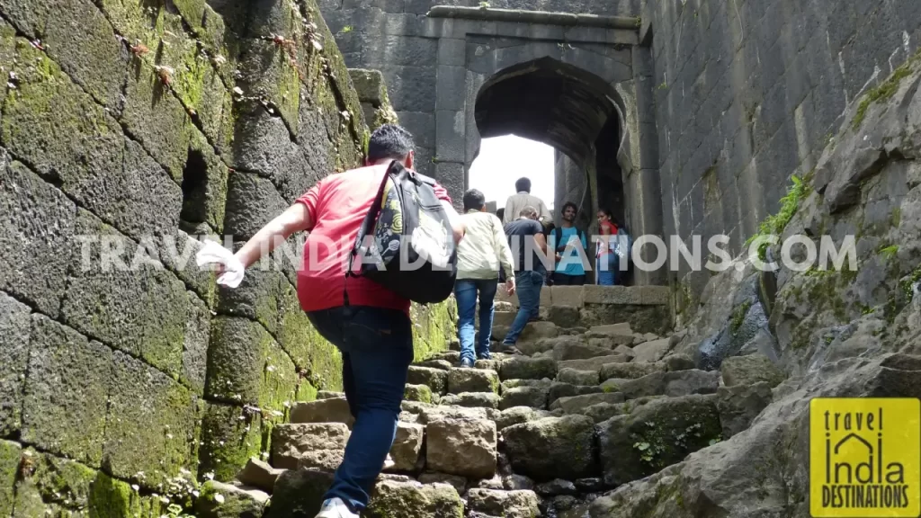
Each gate stands at a different level and was built as part of the fort’s defensive structure. The climb through these arched gateways gets steeper near the top, but the views — and the sense of history — make it worth every step.
If you’re into photography, these gates frame some stunning shots, especially during the monsoon when they’re draped in green.
Reaching The Summit: Views, Ruins and Quiet Moments
The summit of the Lohagad Fort feels like an open field. This allows you to move in any direction and explore history at your pace. The wide plateau offers panoramic views that are worth every drop of your sweat.
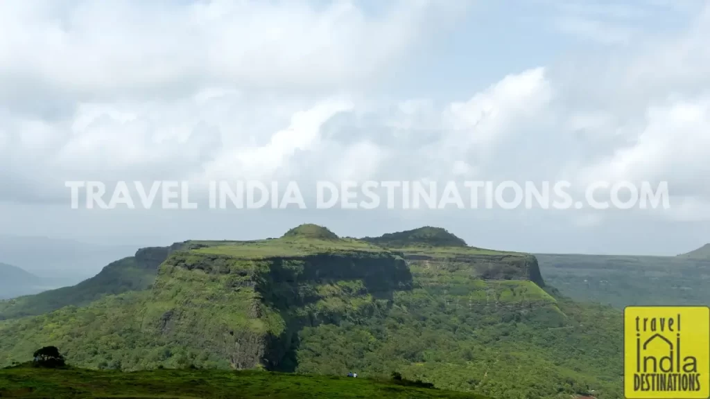
On one side, you’ll see the calm expanse of Pawna Lake shimmering in the distance, while on the other, the mighty silhouette of Visapur Fort rises through the mist. As you explore the fort, you will come across an old dargah (tomb), ancient water wells and various artefacts that whisper stories from the past.
Take your time to soak in the natural beauty and landscape you see around and make the most of your hiking day.
The Iconic Vinchu Kata: A Scorpion’s Tail with a View
Once you’re at the top, exploring the terrain of the Lohagad Fort, you would want to head towards the western section of the fort. But hold your breath before you witness the iconic Vinchu Kata in person.
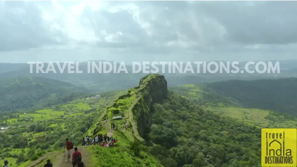
Named after its resemblance to a scorpion’s tail, this narrow fortified ridge is unlike anything you’ve seen before. Walking along its spine offers a unique experience, but if you want to skip it, you can at least enjoy some panoramic shots from above.
After starting our journey on foot from Bhaja Caves, both Sarah and I were practically out of breath. Hence, we decided to pause and reflect on how the day went by and how we were going to proceed with our evening itinerary.

What We Learned (So You Don’t Have To)
You don’t need to train for Lohagad Fort, but a little planning goes a long way. We didn’t — and we felt it.
We started our day at Bhaja Caves, which was brilliant, but by the time we hit the final climb at Lohagad, it was early afternoon, and the sun was in full force. No sunscreen meant we got properly tanned. No pre-hike stretches or warm-up meant sore calves the next day.
And yet — we’d do it again.
Here’s what would’ve made it smoother:
Start Early: Begin before 9 AM if possible, especially if combining this with Bhaja Caves.
Good Footwear is Non-Negotiable: The steps are ancient and slippery when wet. Grip matters.
Carry Water and Sunscreen: You’ll sweat more than you think, even in cloudy weather.
Don’t Rush: This trek isn’t about speed. Take it slow, enjoy the views, and don’t try to impress your group.
Avoid Anything Risky: Stay away from the edge and avoid stunts that can injure yourself and/or someone else.
Skip Rainy Days: Monsoon is beautiful, but rain + mossy paths = risky business.
We also met fellow hikers on the way who made the experience even livelier. Strangers become photographers for each other, and everyone shares in the awe.

Lohagad Fort Trek: Where the Trail Ends, the Memory Begins
As you make your way back from the Lohagad Fort trek, it’s not just the trek that lingers – it’s the memories you’ve made. No wonder, it remains one of the best places to visit in Lonavala on our list.
From the cool wind brushing your face at the summit to the surreal monsoon clouds drifting over Pawna Lake, and the quiet camaraderie shared with fellow hikers, every moment lingers long after the trail ends.
The fort may be centuries old, but the experience feels fresh and personal. Whether it’s the history embedded in its gates, the unexpected monkey encounters, or the serenity at the top, Lohagad leaves you with more than just photos—it leaves you with a story. One you’ll want to relive, and maybe even retell.
Have you experienced the Lohagad Fort Trek? Share your favourite moments or tips in the comments below – we’d love to hear your stories!
15 comments
Thank you for taking us (and your camera) along on this hike. The pictures are beautiful and the description leaves me feeling like I was by your side. Such a beautiful area.
Glad that you felt that way. Mission accomplished.
Simply magnificent Sharukh. This is my very favorite posting of yours to date. I was with you in spirit I know., with the little dragonfly.😉 You all look so beautiful yhere at the summit and what rich cultural history yo be able to share. Of course no battles or wars are full of happiness but still to stand where ancestors stood always brings me a sense of oneness with everything. The landscape is so incredibel. Sarah and you have beautiful, happy smiles there. And now I am lonely for the mountains. Sigh.
Thank you so much for this post. I loved it all!
I’m glad that you felt the place in spirit. I wanted to share the history as well, although the fort was constantly changing hands.
You did a marvelous job. Just enough information really. Love the monkeys! I miss my squirrel monkey friends. Oh but in one of the photos of a wall, what is the writing inscribed on it?
You mean a picture which says Scriptures Carved on a stone?
Sharukh, always an amazing adventure to read your hiking posts. I’m with you every step of the way! Thanks you! Christine
Christine, I’m glad that you enjoyed it reading as much as I enjoyed it writing it down. Overall there are 400 images, these are handpicked ones.
Sounds as if a photo gallery is in order. Maybe a mosaic tile where they are all connected. I love to look at galleries like that. Christine
Will try and work on it.
Great! I’ve done mosaic tile photo galleries for many of my posts. The Welcome Page has lots of sunsets & sunrises from world-wide blogger friends. I just keep adding new ones to the mosaic tile gallery. Check it out for an example.
http://cerobinsonauthor.com
I clicked over from C. E. Robinson’s blog and had a look around. Too much to see in one look, but I viewed this entire post, and thought it was wonderful, especially since everything is quite unfamiliar to me there. When I have more time, I will browse through some more things. Great job!
Thank you for visiting my tiny India travel blog. I’ve tried my best to put up authentic information (not what media shows you on TV about India), so visit as and when you please.
This imformation was amazing and this article you wrote is highly appricating but some of the information is missing in this article lets make it clear for the audiunce who are need the information I have wrote the detail information article on this TOPIC check it out if you like it help me to grow by giving me a backlink.
Thank you for your comment and for taking the time to read my article! I’m glad you found the information helpful. I strive to keep my content concise and focused, and I do appreciate your offer to share links. At this time, I’m selective about external links to maintain quality and relevance, but I’ll keep your article in mind for future updates. Thanks again for reaching out!